Mondorf-les-Bains
 |
It is part of the canton of Remich. Mondorf-les-Bains is a spa town (hence its name), and has the only casino in Luxembourg.
, the commune of Mondorf-les-Bains (other towns within the commune include Altwies and Ellange) has a population of 5,082.
The area was first inhabited by the Celts. The Romans, who arrived in 65 BC, built the Castel on Celtic foundations to protect the road from Metz to Trier. It was one of Charlemagne's nieces, Muomina, who is behind the village's name. In the 9th century, she donated all her possessions including the little village to Echternach Abbey. The village was subsequently called Muomendorph. Over the centuries, Mondorf was frequently attacked, burnt down and rebuilt. St Michael's Church from 1065 was rebuilt on four occasions, the last time in 1764.
It was in the 1840s that the thermal waters were uncovered as a result of deep drilling for salt which had become highly taxed under the Dutch. Karl Gotthelf Kind, who had found salt in Germany and hoped to do the same in Mondorf, discovered the waters after drilling to a record depth of 736 metres. Despite their mineral properties, the waters were not suitable for salt a brownish colour caused by the rich iron content which emerged after distilling. Nevertheless, the local notary, J.-P. Ledure, saw other opportunities for the waters and was successful in finding support for setting up the "Société des Bains de Mondorf". The architect Charles Eydt was immediately commissioned to build the thermal establishment which was inaugurated on 20 June 1847. As a result of the spa's success, the village prospered as rich French guests came to stay in the luxurious hotels which sprang up in the vicinity. The flow of visitors from France was however halted in 1871 when the Germans occupied Alsace and Lorraine.
Despite acquiring the name of Mondorf-les-Bains on 28 August 1878, the spa had been undergoing a significant decline since 1871. Only after the State took over the facilities on 21 April 1886 were its fortunes improved. Minister of State Paul Eyschen was particularly successful in reviving interest, encouraging visitors to come from Belgium. In the early 20th century, the State invested heavily in the resort adding a pavilion for the original source, a banqueting hall and a reading room as well as the Orangerie and the country's first indoor swimming pool. The park was also enlarged. A railway to Thionville was opened in 1903 and, in 1913, the Marie-Adélaïde Source, named after the grand duchess Marie-Adélaïde was added after drilling to a depth of 464 metres.
After a quiet period during the First World War, a new spa centre designed by architect Paul Wigreux was opened in 1926. In the 1930s, the hotels were occupied not by visitors interested in the waters but by émigrés from Nazi Germany. At the same time it was visited by Polish pianist Arthur Rubinstein. During the Second World War, well-to-do Nazis enjoyed relaxing at "Staatsbad-Mondorf", far away from the bombing and fighting. In 1945, Mondorf's Palace Hotel became Camp Ashcan, a prisoner-of-war camp for senior Nazi dignitaries who awaited trials at Nuremberg. During the Allied occupation, that lasted until September 1945, there was no permission to transit in the town from 7 pm to 7 am. The spa continued to prosper in the second half of the 20th century with an outdoor swimming pool (1953), a new thermal centre (1988), and the Casino 2000 which opened in 1983.
Map - Mondorf-les-Bains
Map
Country - Luxembourg
 |
 |
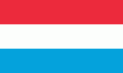
| Flag of Luxembourg | |
With an area of 2,586 km2, Luxembourg is one of the smallest countries in Europe, and the smallest not considered a microstate. In 2022, it had a population of 645,397, which makes it one of the least-populated countries in Europe, albeit with the highest population growth rate; foreigners account for nearly half the population. Luxembourg is a representative democracy headed by a constitutional monarch, Grand Duke Henri, making it the world's only remaining sovereign grand duchy.
Currency / Language
| ISO | Currency | Symbol | Significant figures |
|---|---|---|---|
| EUR | Euro | € | 2 |
| ISO | Language |
|---|---|
| FR | French language |
| DE | German language |
| LB | Luxembourgish language |


